博文
Matlab: NetCDF File
||||
NetCDF (Network Common Data Form) is a set of software libraries and self-describing, machine-independent data formats that support the creation, access, and sharing of array-oriented scientific data. The project homepage is hosted by the Unidata program at the University Corporation for Atmospheric Research (UCAR). They are also the chief source of netCDF software, standards development, updates, etc. The format is an open standard. NetCDF Classic and 64-bit Offset Format are an international standard of the Open Geospatial Consortium.
Displaying netCDF data under ArcGIS 10
以sst.mon.ltm.1981-2010.nc(details)文件为例,SST(Sea Surface Temperature)在ArcGIS10.2中显示如图 1。
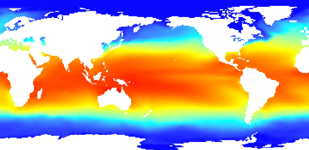
图 1
Matlab操作
以sst.mon.ltm.1981-2010.nc文件为例,Matlab操作读入及输出为GeoTiff文件。
1.0 degree latitude x 1.0 degree longitude global grid (360x180).
89.5N - 89.5S, 0.5E - 359.5E.
Missing grids are 9.999e+20(ltm).
代码运行生产Jan.~Dec.全球SST,程序运行流畅。
附上代码及测试数据(![]() NCTest.rar)。
NCTest.rar)。
See Also
https://m.sciencenet.cn/blog-1148346-885952.html
上一篇:Python: Installing Scipy Package
下一篇:Matlab: Size Suitable to View with Smart Phone