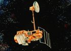
Background The Landsat program is the longest running enterprise for acquisition of satellite imagery of Earth. On July 23, 1972 the Earth ResourcesTechnology Satellite was launched. This was eventually renamed to Landsat. The most recent, Landsat 8, was launched on February 11, 2013. Timeline for a variety of Landsat instruments: Fig. 1 On May 31, 2003 the Scan Line Corrector (SLC) in the ETM+ instrument failed. So the named data as SLC-off means that data acquired after that day, on the contrary, SLC-on before . Bands of True Color Landsat 8: 432 Landsat 7: 321 Landsat 5: 321 Landsat 4: 321 Landsat MSS Get Data Browse and Download Data - GloVis Search and Bulk-Download Data - EarthExplorer (推荐使用Google Chrome打开该网站,其他浏览器可能不能正常展开Google Map) 两个站点的用户名(密码)通用,不用重复注册。 References Landsat 8 可以免费下载了 . USGS Landsat - home page . NASA Landsat - home page . Landsat program, from Wikipedia . Landsat 7, fromWikipedia .
As part of the Global Forest Resources Assessment 2010 (FRA 2010), the UNFAO and its member countries and partners will undertake a global remote sensing survey of for ests. This survey will substantially improve knowledge on forest dynamics, including deforestation, afforestation and natural expansion of forests. The primary aims of the new global survey are to obtain information on the distribution of forests and on changes in forest area over time at regional, biome and global levels.
 标签: Landsat